
Yamanami Highway

Verified [Verified] denotes information that has been published with confirmation of its owing parties.

Yamanami Highway

A classic scenic drive that’s been selected as one of the “Japan’s Top 100 Roads.”

3.30 3

Last update :
Supervised by :  Yamanami Highway

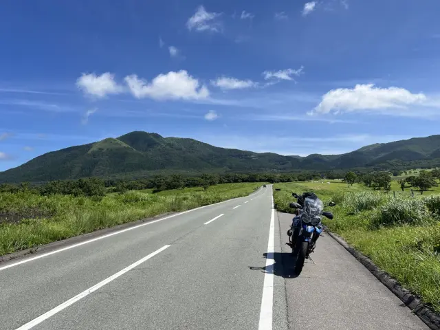
The Yamanami Highway is the nickname for Prefectural Route 11, which runs from Beppu in Oita Prefecture to Ichinomiya in Kumamoto Prefecture. The route offers a refreshing drive with sweeping views of the majestic Kuju Mountain Range and other stunning scenery.

Along the roughly 50km route, you’ll find numerous highland viewpoints, tourist ranches, hot springs, and more-there’s no shortage of places to stop and explore. Be sure to set aside plenty of time so you can enjoy a leisurely, spontaneous drive.

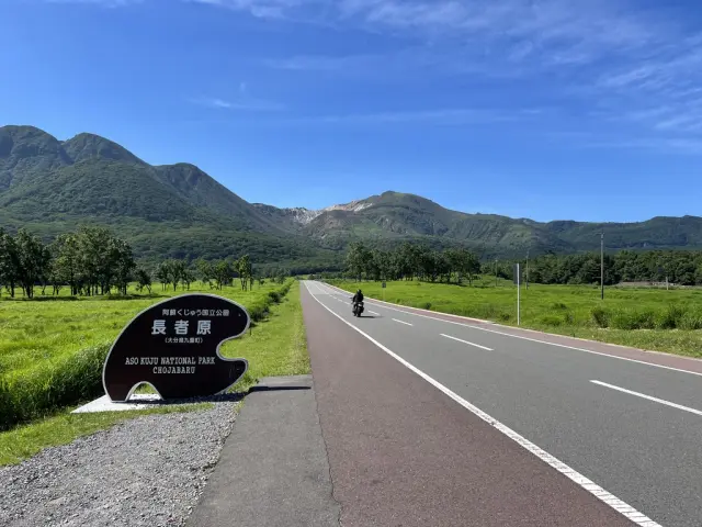
Among the many highlights, the view from Chojabaru is not to be missed. From here, you can see Mt. Io spewing steam right before your eyes-an impressive sight. The panoramic view from Makinoto Pass, the highest point of the Yamanami Highway, is also a must for your camera. Stopping at roadside facilities to enjoy local food and shopping is another great way to experience the route.

Do note that cows and horses grazing nearby may occasionally wander onto the road, depending on the location. The route also has many curves, so be sure to drive carefully and avoid excessive speed.

Highlights

  • A spectacular driving route connecting Beppu in Oita Prefecture with Ichinomiya in Kumamoto.
  • Along the way, you’ll find highlands, tourist ranches, hot springs, and drive-ins-perfect spots to explore.
  • Be cautious of animals that may wander onto the road, and avoid driving too fast.

Photos

  • View of the majestic Kujū Mountains from Chojabaru

    View of the majestic Kujū Mountains from Chojabaru

  • Makinoto Pass, the highest point along the drive

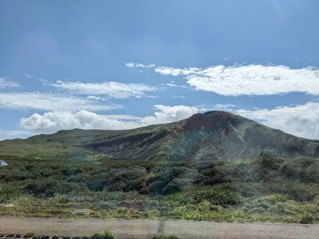
    Makinoto Pass, the highest point along the drive

  • The sweeping grasslands of Senomoto Kōgen, a stunning highland landscape

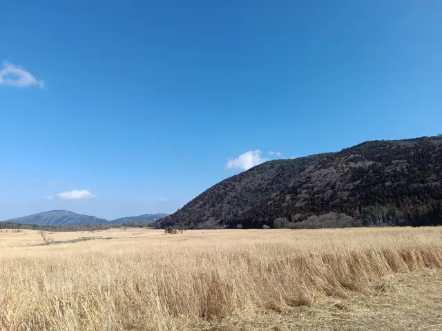
    The sweeping grasslands of Senomoto Kōgen, a stunning highland landscape

Official FAQs

Frequently Asked Questions have been vetted and answered directly by each listing.

Q

Are there any foreign-language brochures or informational signs? If so, which languages are available?

A

There are English signs around the Chojabaru area. In addition, the Kokonoe Town tourism website is available in English, Chinese, and Korean, and there are trilingual brochures (English/Chinese/Korean) for the Tadewara Marsh.

Q

Is free Wi-Fi available in the area?

A

Free Wi-Fi is available in the Chojabaru Visitor Center.

Q

Are there restrooms nearby?

A

Yes. Restrooms are available at various rest stops along the highway.

Q

Is parking available?

A

Yes. Most rest areas along the route have parking. Around the Chojabaru Visitor Center, there are approximately 450 parking spaces.

Q

How many municipalities does the Yamanami Highway pass through?

A

It passes through the following municipalities:
Oita Prefecture - Beppu City, Yufu City, Kokonoe Town, Taketa City
Kumamoto Prefecture - Aso City
You can find sightseeing information on each municipality’s official website.

Q

Are there hot springs, hotels, or restaurants along the route?

A

Yes, there are plenty of hot springs, accommodations, and dining options along the highway.

Q

Are there gas stations?

A

Gas stations can be found at some rest areas along the route.

Q

Can I rent a bicycle?

A

Yes. Bicycle rentals are available near the Chojabaru Visitor Center.

Q

Is there a recommended map for the Yamanami Highway?

A

The “Japan Scenic Byways - Kyushu Transversal Route: Yamanami Highway” map is recommended.
It covers the entire route and includes QR codes linking to videos with sightseeing information along the highway.

Reviews

3

Some reviews are AI-translated.

  • See More

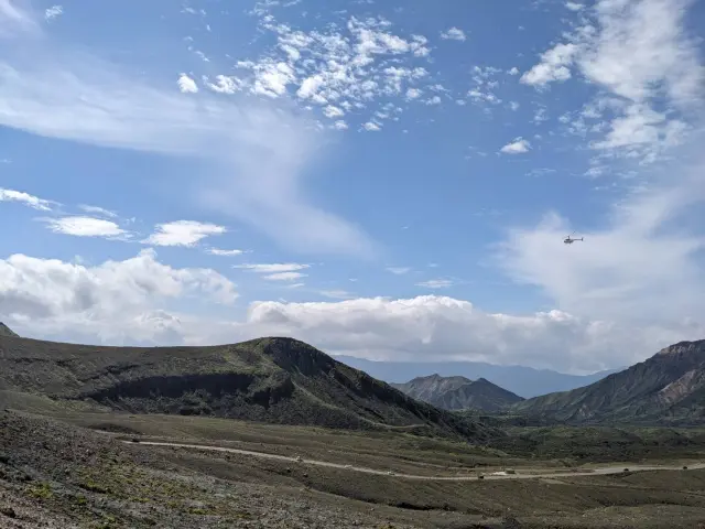
    Taking a trip to Aso is, in my opinion, a great way to get to know Kumamoto. It doesn't take too long to get there from the city—after about an hour, the scenery outside the window gradually begins to change, slowly shifting from familiar city streets to endless green grasslands and mountain views, as if you've entered another world. The scenery along the way is soothing and relaxing, making you want to slow down and fully take in Aso's natural beauty. Looking down from the mountain road, the cars traveled neatly one after another along the winding road, looking as cute as little Tomica cars from a distance! We also happened to see a helicopter flying across the sky in the distance. Together with the traffic on the ground, it created views from different heights. I imagined that looking down from the air at Aso's magnificent volcanic terrain and grasslands must be beautiful too.

  • See More

    I was really looking forward to driving the Yamanami Highway on a road trip through Kyushu. This time I came specifically to Chojabaru. I originally thought the entrance and parking lot would be easy to find, but once I arrived, I realized the directions were a little confusing. I drove around for a bit before finally finding a place to park.

    After parking and walking over to the Yamanami Highway, the view immediately made the search feel worthwhile. The wide-open grasslands, the mountain ranges in the distance, and Kyushu's fresh air made the whole view very pleasant.

    There's also a Montbell nearby where you can stock up!

  • See More

    When you think of the Yamanami Highway, you think of Chojabaru. It's the quintessential route for road trips and motorcycle tours in Kyushu! Since it's at a high elevation, the highlands are comfortable even in summer. It's a great road I'd love to drive again and again!

Details

Name in Japanese
やまなみハイウェイ
Address
From Ogura, Beppu City, Oita to Ichinomiyamachi, Aso City, Kumamoto
Telephone
0973-79-2381 (Kuju Handa-kogen Tourist Information)
0973-79-2154 (Chojabaru Visitor Center)
*Both located in the same building.
Closed
Free to walk
Business Hours
Walk anytime
Admission
Free
Credit Cards
Not accepted
Hokkaido Tohoku Kanto Chubu Hokuriku Kansai Chugoku Shikoku Kyushu Okinawa