
Verified [Verified] denotes information that has been published with confirmation of its owing parties.
Mt. Fujiwara
A beginner-friendly mountain offering summit views and a variety of alpine plants.
Located on the border between Inabe City in Mie Prefecture and Higashiomi City in Shiga Prefecture, Mt. Fujiwara is a 3,740-foot mountain at the northern end of the Suzuka Mountains. Popular for its accessible hiking trails and seasonal flowers, it attracts more than 50,000 visitors annually.
The view from the ninth station is one of the highlights of the hike. The Suzuka Mountains stretch to the south, while Mt. Ontake and the Japanese Alps can be seen to the east. On clear days, Mt. Fuji may also be visible. Mt. Fujiwara lies where two botanical regions meet, allowing plants from both regions to coexist. It is also known as one of Japan's “100 Famous Flower Mountains” for its many alpine plants. The delicate Amur adonis and winter aconite flowers attract especially large numbers of hikers from around March to April.
Two hiking routes lead to the summit, each about 2.5 miles long and requiring approximately six hours for a round trip, making a day hike possible. Signs along the trails indicate the current station, helping make the hike approachable even for beginners. Hiking maps are available from the Commerce and Tourism Division of Inabe City Hall's Agriculture, Forestry, Commerce and Industry Department and at locations throughout the city.
Highlights
-
A 3,740-foot mountain at the northern end of the Suzuka Mountains.
-
Popular as a beginner-friendly mountain suitable for day hikes.
-
Views of the Suzuka Mountains and the Japanese Alps from the summit.
-
Known as one of Japan's “100 Famous Flower Mountains” for its many alpine plants.
-
Hiking maps are available from the Commerce and Tourism Division of Inabe City Hall's Agriculture, Forestry, Commerce and Industry Department and at locations throughout the city.
Photos
-
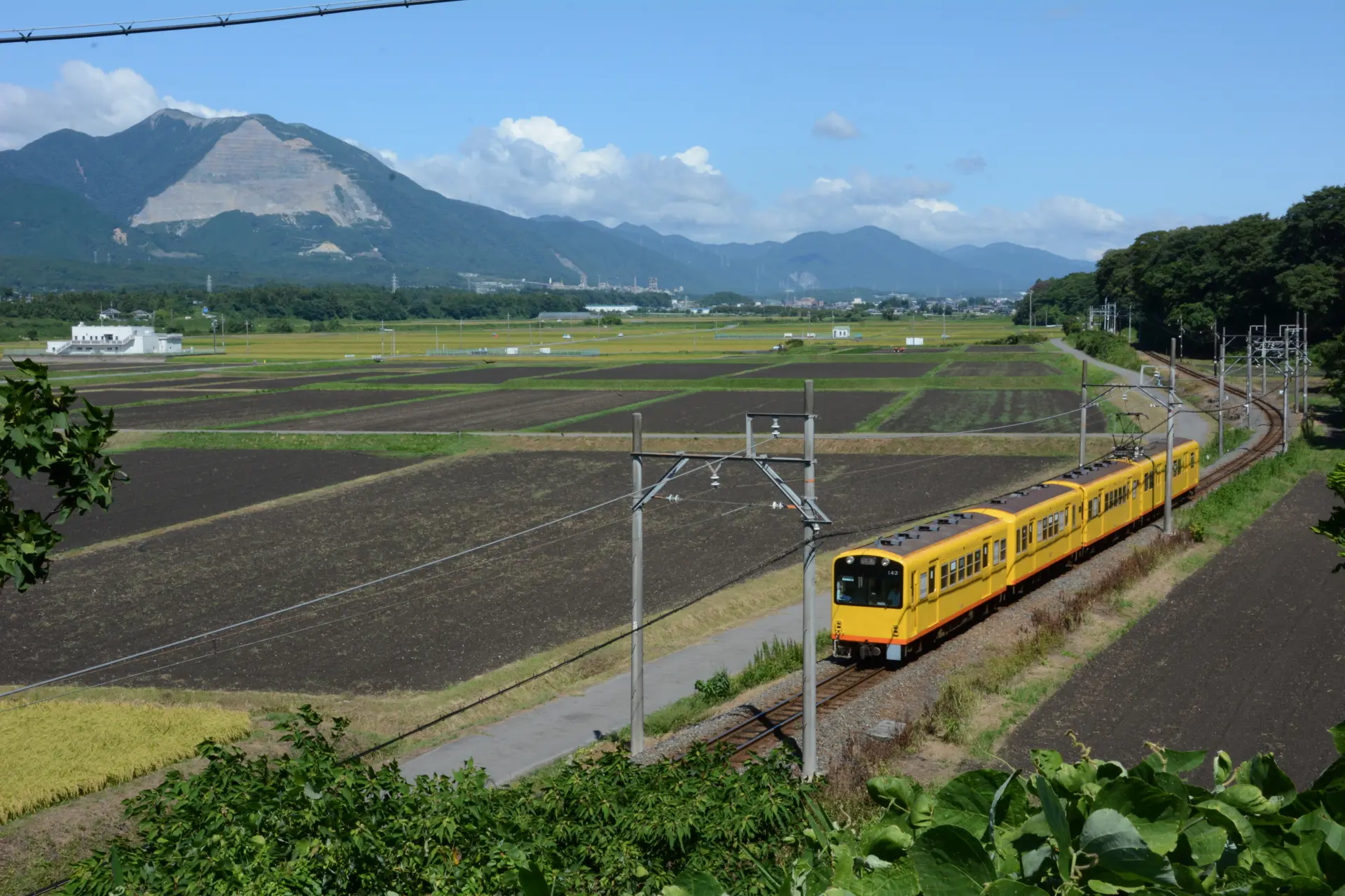
A popular day-hiking destination for beginners
-
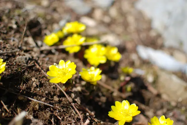
Home to many delicate alpine plants and recognized as one of Japan's “100 Famous Flower Mountains”
Official FAQs
Frequently Asked Questions have been vetted and answered directly by each listing.
Q
Are foreign-language brochures or information signs available? If so, which languages are supported?
No foreign-language brochures or information signs are available.
Q
Is free Wi-Fi available in the area?
No free Wi-Fi is available in the area.
Q
Are restrooms available?
Restrooms are available at the Ogaido Trailhead Rest Area and the summit.
Q
Is there a designated smoking area?
There is no designated smoking area.
Q
Are there any nearby tourist attractions?
Nearby attractions include Shoboji Temple and Inabe Plum Grove Park.
Reviews
Details
- Name in Japanese
- 藤原岳
- Postal Code
- 511-0431
- Address
- Betsumyo, Hokusei-cho, Inabe City, Mie Prefecture
- Phone
- 0594-86-7833 (Commerce and Tourism Division, Agriculture, Forestry, Commerce and Industry Department, Inabe City Hall)
- Access
- A 5-minute walk from Nishi-Fujiwara Station on the Sangi Railway Sangi Line to the trailhead
- Credit Cards
- Not accepted
- Official website
- Official website (Japanese)